Climate & Weather Data
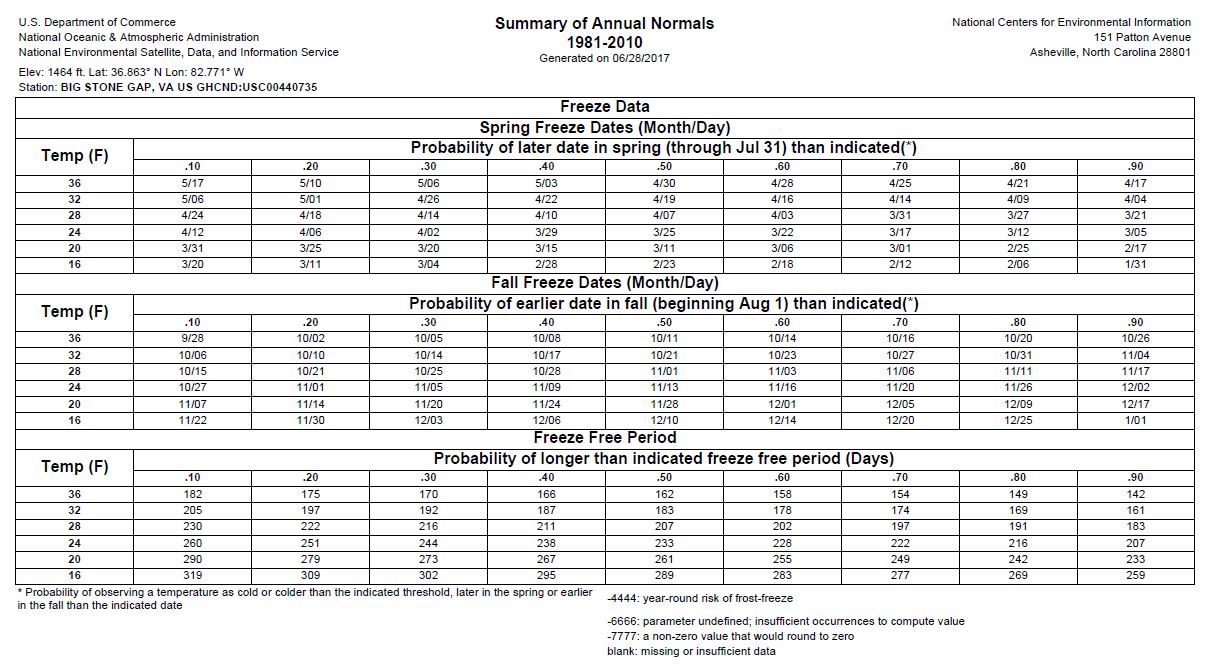
After searching the National Center for Environmental Information, I have included data from counties within the Upper Clinch River watershed in Virginia: Tazewell, Russell, Wise, and Scott County. Within the images below, there is a Global Summary (2016) and Annual Report (1981- 2010) from the following sites: Big Stone Gap (Wise County), Wise (Wise County), Richlands (Tazewell), Burkes Garden (Tazewell). There is also 2016 Global Summary on Lebanon (Russell) with no Annual Report to accompany, and a Gate City Global Summary 2015 with no Annual Report.


Above is a Horticultural Zoning Map of Southwest Virginia from the USDA. This map show climate in relation to plants that are most likely to survive in the locality.


Comments
Post a Comment