Popular posts from this blog
Climate & Weather Data
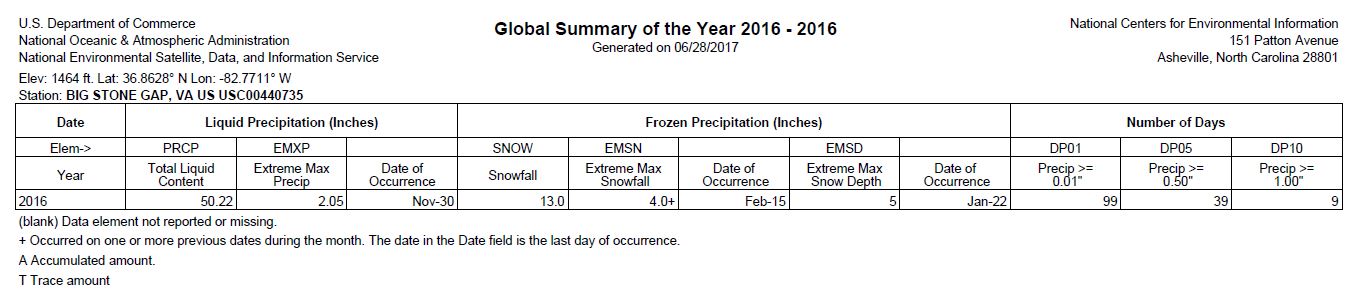
After searching the National Center for Environmental Information, I have included data from counties within the Upper Clinch River watershed in Virginia: Tazewell, Russell, Wise, and Scott County. Within the images below, there is a Global Summary (2016) and Annual Report (1981- 2010) from the following sites: Big Stone Gap (Wise County), Wise (Wise County), Richlands (Tazewell), Burkes Garden (Tazewell). There is also 2016 Global Summary on Lebanon (Russell) with no Annual Report to accompany, and a Gate City Global Summary 2015 with no Annual Report.
Web Soil Survey
Below are maps from USDA Web Soil Survey. The locations captured are the four counties apart of the Upper Clinch River watershed. At the bottom of each map is a table outlining the soils which held over 3% composition within the county. This tool (USDA Web Soil Survey) was a wealth of knowledge. It's easy to forget what one is looking for after discovering all of the features the site offers. I listed the basics on the blog, but clicked on other levels to explore in depth. The website was easy to navigate, but at times I didn't understand the material shown. With more knowledge of soils and more time dedicated to this site, this tool would be useful for future projects.
Comments
Post a Comment